New funding will see CDU and Environs Kimberley use drones to help monitor desert and savanna habitat
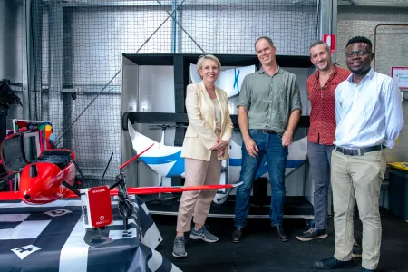
Charles Darwin University (CDU) and Environs Kimberley (EK) researchers, along with Kimberley partners, will soon be looking to monitor how fire management changes the structure and condition of about 43,000 km2 of savanna and desert vegetation using data collected by drones and satellites.
The project, which has received funding of $446,843 from the Australian Government as part of the Innovative Biodiversity Monitoring Grants program, will develop methods to measure the structure of vegetation in large desert and savanna landscapes in the Kimberley region of WA using drone-based and satellite-based optical, radar, and lidar imagery.
Currently, assessments of the structure of vegetation in these environments relies on on-ground surveys which are time consuming, expensive to undertake and limited in their ability to sample large areas.
Professor of Wildlife Conservation at CDU’s Research Institute for the Environment and livelihoods and project team member Professor Sarah Legge said undertaking these assessments is vital for understanding how fire management is changing habitat quality for animals.
“Many ground-dwelling animals in desert and savanna environments require certain vegetation structural characteristics to persist,” Professor Legge said.
“Vegetation structure is determined partly by the climate but also by the frequency of fire, grazing and trampling by feral animals and invasion by weeds.
“We tend to assume that if we manage fire and feral animals, then the vegetation structure and condition will improve for animals. The proposed solution would mean that Indigenous organisations and pastoralists can monitor changes in vegetation structure and habitat condition directly, and use that information to improve management.”
Drone and satellite lidar provide 3D structure of the vegetation, and can be complemented with spaceborne active radar, which is better able to see through cloud cover and the tree canopy to provide reliable information on ground-level habitat structure.
CDU Lecturer in Remote Sensing Dr Richard Crabbe will lead this project, and said this proposed solution can be used to assess habitat conditions at much larger scale.
“On-ground surveys, whilst effective, typically only cover an area of less than 0.25 ha at a time, in contrast, drone-based imaging could cover areas of about 1 km2 at a time and satellite-based imaging could characterise vegetation structure across 1000s of square kilometres,” Dr Crabbe said.
“The satellite-based radar technology also provides high resolution and potentially uninterrupted data that will help us to improve biodiversity metrics.”
This project is a collaboration between CDU, Environs Kimberley, the Karajarri Rangers, and the Dampier Peninsula Fire Working Group, including Rangelands NRM, pastoralists and the Bardi Jawi Rangers, Nyul Nyul Rangers, and Yawuru Country Managers.
The on-ground survey data will continue to be collected by the rangers.
Environs Kimberley Ecological Projects Director Dr Malcolm Lindsay said the project would have significant benefits and its results would be relevant across the nation.
“The project will build on existing partnerships between scientists, Aboriginal Rangers and pastoralists managing three habitats in the Kimberley: spinifex deserts, tropical savanna and endangered rainforests,” Dr Lindsay said.
“This means that project results will immediately inform and benefit on-ground management of country, whilst being relevant to many other parts of Australia.
“A strength of the project is that it will simultaneously utilise multiple types and scales of knowledge to track how biodiversity is changing, combining indigenous knowledge of country with scientific information from detailed on-ground biodiversity surveys, medium scale drone mapping, and large-scale satellite imagery and radar.
“The issue of biodiversity loss in Australia is enormous and complex, we can only monitor and manage it if we address it at multiple scales with multiple stakeholders.”
The Innovative Biodiversity Monitoring grants aim to provide baseline assessment and monitoring technologies and approaches for use across Australia.
CDU is one of 12 projects that received funding as part of this program.
Quotes attributable to the Minister for the Environment and Water, the Hon Tanya Plibersek:
“We’re lucky to have some of the best minds who are passionate about finding new ways to better protect our precious environment.
“It’s exciting to see new ideas and projects like using drones to better understand, monitor and record vital information about our environment. This information is crucial in our fight to protect nature from threats like climate change, natural disasters and predators.
“By investing in biodiversity monitoring projects like this, we will also be able to better protect threatened plants and animals.
“Labor is committed to protecting Australia’s precious and unique plants and animals and leaving nature better off for our kids and grandkids.”
Related Articles

Australia ranked among world's top countries for quality of life
Australia is one of the world's best countries for overall quality of life, according to an international study into what truly drives well-being.
Read more about Australia ranked among world's top countries for quality of life
CDU invests $2m in First Nations research scholarships
In a push to engage more First Nations students, Charles Darwin University (CDU) is investing up to $2 million in Higher Degree by Research (HDR) scholarship initiatives to strengthen pathways, participation and success for First Nations researchers.
Read more about CDU invests $2m in First Nations research scholarships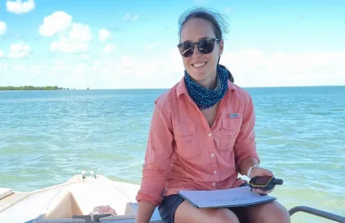
Shell yeah: PhD project gives critical insights into vulnerable species
A study into the foraging habits of green turtles in the Northern Territory has used an innovative surveying technique which could become a critical tool in monitoring marine habitats in remote and challenging environments.
Read more about Shell yeah: PhD project gives critical insights into vulnerable species


