News
New mapping technology gives land managers another tool to protect landscapes and make the most of carbon trading offsets
Planned high-resolution satellite mapping will help land managers reduce bushfires and increase carbon-offset income for communities in the Northern Territory.
The Earth observation product will be developed with $97,000 funding from the Northern Territory Government and technical support from Geoscience Australia through the EO4NT grant program.
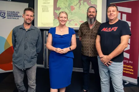
Charles Darwin University (CDU) spatial software engineer Dr Patrice Weber who leads the project said the North Australia Fire and Rangeland Information service (NAFI) will be developing new software to acquire high-resolution satellite images and apply sophisticated mapping algorithms to identify burnt areas.
“This mapping will greatly improve risk mitigation planning and operational response for bushfires that impact agencies and businesses in the NT,” Dr Weber said.
CDU researcher Dr Rohan Fisher said the new maps would be a tool to improve land management, and to reduce risk from wildfire for remote communities.
“There are many Indigenous-led businesses that have been created because they protect and manage their land for the benefit of everyone,” he said.
“It’s the backbone of the carbon economy. When putting value in our natural resources and ecosystems we are also giving communities the tools to manage their own lands and commercial opportunities.”
Dr Fisher said the grant would help to improve fire management, which helps to increase income for the communities.
“Our clients are wide-ranging and work in industries including agriculture, pastoralism, defence, police, Aboriginal rangers, landowners and government services. The product that this grant makes possible will likely attract new customers, including from the carbon emission abatement industry and fire management proponents,” Dr Fisher said.
Minister for Industry, Nicole Manison, said the EO4NT grant helps support important projects such as those being undertaken by CDU.
“This technology will help business, industry and government to make critical decisions on issues such as bushfires and their impact on our community,” Minister Manison said.
“The EO4NT grant recipients like CDU demonstrate the enormous potential for Earth observation-derived business and industry solutions to grow and thrive in the Territory.”
Related Articles

Australia ranked among world's top countries for quality of life
Australia is one of the world's best countries for overall quality of life, according to an international study into what truly drives well-being.
Read more about Australia ranked among world's top countries for quality of life
CDU invests $2m in First Nations research scholarships
In a push to engage more First Nations students, Charles Darwin University (CDU) is investing up to $2 million in Higher Degree by Research (HDR) scholarship initiatives to strengthen pathways, participation and success for First Nations researchers.
Read more about CDU invests $2m in First Nations research scholarships
Shell yeah: PhD project gives critical insights into vulnerable species
A study into the foraging habits of green turtles in the Northern Territory has used an innovative surveying technique which could become a critical tool in monitoring marine habitats in remote and challenging environments.
Read more about Shell yeah: PhD project gives critical insights into vulnerable species


