News
CDU Fire trackers receive additional funding to help with land management across Northern Australia
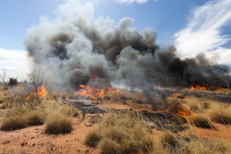
Fire season in the Northern Territory is officially upon us, and Central Australia is not out of the inferno just yet.
CDU's Northern Institute Research Development Officer and fire expert Rohan Fisher is worried there is still time for a massive fire event in the Central Desert region.
“In the desert, fire burns where water flows because that’s where fuel, in the form of vegetation, is heaviest.”
Over the past year Alice Springs and its surrounding areas has had one of the wettest seasons on record leaving the desert full of large fuel zones that are highly flammable.
Parts of Alice Springs were under a Watch and Act alert over the Easter long weekend, and fires west of Alice could be seen from space. Additional fire services have been flown to Alice Springs as a precautionary measure to help mitigate any additional risks.
Mr Fisher said even as the weather cools it is important to be aware that the fuel and vegetation is still there.
“The reality is that the threat doesn’t just go away after summer ends, the fire fuel will still remain and will be ready for when the extreme heat returns.”
In the top end of the Territory the lead up to fire season has just begun with locally managed burn-offs, however in Central Australia, fire management is not done to the same scale.
“Northern Australia is prone to large yearly fires therefore, the fire management is much more embedded into land management practices, the same cannot be said for Central Australia,” Mr Fisher said.
Experts are worried that if the expected fires do happen they could have a devastating impact on remote communities, local tourism as well as the agriculture sector.
“Fires have the potential to impact First Nation’s way of life, flora and fauna as well as local industries such as tourism or the pastoral sector,” Mr Fisher said.
To help combat the fires and continued land management the Disaster Resilience and Recovery Agency announced an additional $775,000 dollars towards CDU's Research Institute Environment & Livelihoods (RIEL) Northern Australia and Rangelands Fire Information service (NAFI).
The service provides real-time bushfire information via a web service and on smart phones through the NAFI mobile app and is highly regarded across northern Australia and beyond as it now maps over 70% of the continent.
Mr Fisher explained that this is the 19th year that NAFI has been providing critical fire information across Northern Australia and the Rangelands -underpinning a large and growing carbon abatement industry on First Nation’s land and supporting pastoral land management.
“NAFI probably has had the greatest long-term impact on supporting First Nation’s livelihoods, the pastoral industry, and the ecology of northern Australia - and has become deeply embedded in the culture of land management across northern Australia,” he said.
Visit the NAFI website to find out more about fire mapping and tracking - Northern Australian Fire Information (firenorth.org.au)
Related Articles

Australia ranked among world's top countries for quality of life
Australia is one of the world's best countries for overall quality of life, according to an international study into what truly drives well-being.
Read more about Australia ranked among world's top countries for quality of life
CDU invests $2m in First Nations research scholarships
In a push to engage more First Nations students, Charles Darwin University (CDU) is investing up to $2 million in Higher Degree by Research (HDR) scholarship initiatives to strengthen pathways, participation and success for First Nations researchers.
Read more about CDU invests $2m in First Nations research scholarships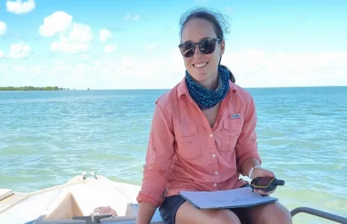
Shell yeah: PhD project gives critical insights into vulnerable species
A study into the foraging habits of green turtles in the Northern Territory has used an innovative surveying technique which could become a critical tool in monitoring marine habitats in remote and challenging environments.
Read more about Shell yeah: PhD project gives critical insights into vulnerable species


