RIEL seminar series
Vegetation classification in the Northern Territory
| Presenter | Dr Donna Lewis | |
|---|---|---|
| Date/Time |
to
|
|
| Contact person |
Robin Leppitt
|
|
| Location | Casuarina campus, Yellow 1.1.39 | |
| Open to | Public | |
Various vegetation classification systems have been applied to plot-based vegetation data in the Northern Territory since the 1990s. About a decade ago, the national vegetation guidelines and National Vegetation Information System (NVIS) were adopted and continue to be used as the standard classification system and field protocol in the Northern Territory. Parallel to implementing the national guidelines, the Northern Territory Vegetation Site Database was developed to store hierarchical plot data. The system has semi-automated tools that can classify plot data equivalent to levels two (structural formation), five (association) and six (sub-association) of the NVIS Information Hierarchy. As a result of inconsistencies between surveys and varying degrees of floristic and structural information collected in the field, only a portion of the data is compliant with the NVIS hierarchical levels.
Classification of plot data in the Northern Territory is more commonly used for vegetation mapping. The only Territory-wide vegetation classification is the 1:1 million vegetation map where 112 broad vegetation types were described from an intuitive appraisal of numerical analytical techniques. This hybrid approach continues to be used, however a standard method needs to be developed in the Northern Territory to classify plot data into meaningful vegetation types. The key challenges ahead are to collect standardised plot data that is transferrable and can comply with a consistent vegetation classification for Australia. In addition to reviewing the compatibility of plot data to NVIS, we also describe how it conforms with the International Vegetation Classification.
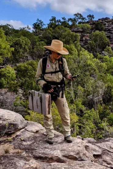
Dr. Donna Lewis has just commenced with TERN as Curation Lead as part of the Ecosystem Surveillance Program. Prior to this role, Donna was Senior Botanist with the Department of Environment, Parks and Water Security. Donna has 20 years’ experience in botanical and ecological field survey across the Top End, and been involved in developing guidelines and field methods in the NT since 2001. Donna previously maintained the NT Vegetation Site Database, HOLTZE – Herbarium Specimen Database and developed the Flora NT website. Donna’s responsibilities with TERN include supporting and developing ecological field survey protocols that aim to enable interoperable data between jurisdictions, improve curatorial workflows, and lead complex on-site field botanical surveys within the remit of TERN Surveillance.
Related Events

The Dr Bilawara Lee OAM (Aunty B), Faculty of Health Public Lecture
Bernard Salt explores how the aging baby boomer generation and a post-pandemic shift toward wellness will drive unprecedented demand and consumer expectations within Australia’s healthcare sector and "care economy" through 2036.
Read more about The Dr Bilawara Lee OAM (Aunty B), Faculty of Health Public Lecture
Freedom of Political Communication and Social Cohesion
The 15th Austin Asche Oration features The Hon. Justice Marcus Solomon SC, who will examine how debates surrounding free speech, rising prejudice, and declining social cohesion are reshaping Australia's legal and political landscapes.
Read more about Freedom of Political Communication and Social Cohesion
Razzle Dazzle Your Research!
Want to improve the way your research is seen, cited, and funded? Increase the visibility and discoverability of your research without adding to your workload?
In this 45 minute workshop, learn how small, strategic tweaks to keywords, research profile details and even Field of Research (FoR) —taking only minutes—that can significantly boost how your research is discovered and valued
You will walk away with a clearer understanding of how your research is picked up by and 'seen' and counted in various systems like Scival, search engines and more.
This isn’t about compliance—it’s about visibility, impact, and career advantage and how just a few minutes can make your research count in a much bigger way.
Read more about Razzle Dazzle Your Research!


