RIEL News
Journeying through the Indigenous Mapping Workshop 2024
Deadly data, hailstorms, flying virtually through digital landscapes, and powerful Mob collaboration — from 2-6 September 2024, Winyama’s National Indigenous Mapping Workshop (IMW) in Boorloo (Perth) had it all.
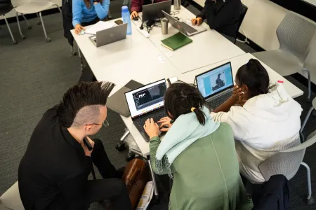
Stephanie Lee, a new PhD candidate with the Research Institute for the Environment and Livelihoods (RIEL) at Charles Darwin University (CDU), arrived at the workshop from Canberra, alongside colleagues Kerri Hunter and Romy Hunter (Nyangumarta rangers) and Hayley Mulardy (Karajarri ranger) who had travelled from Bidyadanga. Initially, the four felt apprehensive about their limited mapping experience but soon realised they had nothing to worry about.
In total, 103 participants from 60 organisations across Australia enjoyed a week filled with courses and experiences. The courses — which covered everything from drones to data sovereignty to Google Earth 3D storytelling — focused on providing Indigenous Australians training across geospatial tools and technology, and empowering attendees to manage their own data and participate in the digital economy. The courses were pitched at all skill sets, from entry level through to those with intermediate and advanced technology experience.
Kerri, Romy and Hayley attended drone training, building on their existing skills. Kerri was also interested in the potential of Esri Field Maps for her work. Meanwhile, Stephanie, whose PhD focuses on fire scar analysis, undertook the QGIS and Google Earth workshop sessions. Despite starting at an entry level, she had no trouble keeping up with the courses, thanks to Winyama staff guidance and Romy’s experience.
The team enjoyed hearing from Moka Apiti (New Zealand), who is of the Ngati Hikairo, Ngati Te Wehi, Ngati Wairere, Ngati Prou, and Te Whanau a Apanui iwi, and Anishinaabe leader Steve DeRoy (Canada), who is Anishinaabe/Saulteaux, and is from the Ebb and Flow First Nation and Lake Manitoba First Nation, both in Manitoba, about how their communities are using tech tools.
Stephanie, Kerri, Romy and Hayley are looking forward to meeting again on Karajarri Country and Nyangumarta Country over the next three years for the ‘Improving Desert Fire Management with Culturally Directed Science’ project, which is a collaboration between RIEL, the Nyangumarta, Karajarri, Ngururrpa and Ngurrara rangers and their respective Aboriginal corporations, Environs Kimberley, and the Indigenous Desert Alliance.
This project will use fire scar analyses, combined with the knowledge of Traditional Owners, to guide Indigenous rangers’ setting of culturally appropriate fire targets within their management plans, and determination of where efforts should be focused within the four ranger groups’ vast Native Title areas in north-western Australia. A recently released Nyangumarta film captures some of the stories and efforts this project spans.
Winyama has been delivering annual IMWs in Australia since 2018. These free workshops provide training on effective mapping technologies and techniques for managing digital information. Beyond the training, IMWs are culturally rich and culturally safe spaces for building relationships and collaborating with others working across the Indigenous land estate.
People interested in future IMWs can attend in person, take courses online, or contact Winyama to discuss the possibility of regional workshops.
This story was originally published in CDU Uni News November 2024 edition
Related Articles
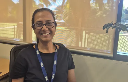
Project examines fisheries and aquaculture work through gender lens
Nilanjana Biswas’s PhD project explores the under-researched role of women in the NT’s commercial seafood sector. Using a gender lens and mixed methods, it examines historical contributions, structural barriers, and policy impacts, making it one of Australia’s first studies in this field.
Read more about Project examines fisheries and aquaculture work through gender lens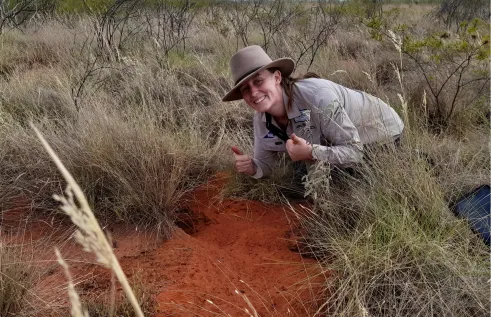
Producing practical recommendations for bilby conservation
Over a multi-year journey, Hayley Geyle completed a valuable PhD project focused on the ecology of the greater bilby. The work centred on improving understanding of the ecology, distribution, and abundance of the bilby in arid and semi-arid Australia, particularly in the NT which is one of the species’ last remaining strongholds.
Read more about Producing practical recommendations for bilby conservation
Preserving genetic diversity of endangered rabbit-rats
Bryn Pickering focused closely on brush-tailed rabbit-rats (Conilurus penicillatus) during his honours year. In particular, he aimed to evaluate the viability of a population of rabbit-rats that were translocated from mainland Cobourg Peninsula onto Greenhill Island, within Garig Gunak Barlu National Park in the NT.
Read more about Preserving genetic diversity of endangered rabbit-rats


