Water and catchments

Why investigate water and catchments with RIEL?
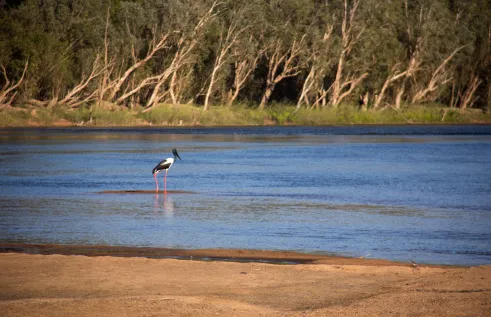
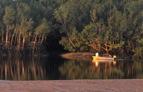
Rivers, estuaries and wetlands in northern Australia are relatively undisturbed providing unique natural laboratories
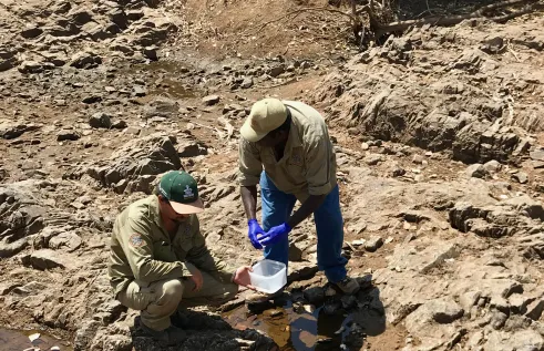
Research is needed to safeguard drinking water quality in remote communities
Surface and groundwater use, relationships and sustainable yields in the north require further study to inform wise development
RIEL conducts internationally-recognised research to understand and improve the management of freshwater, estuarine, coastal and marine systems in northern Australia and globally. Indigenous partnerships are an intrinsic part of our research approach.
Our research includes:
- fish and fisheries ecology
- extinction risk assessments
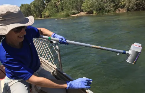
- groundwater and surface water biodiversity assessment and monitoring
- modelling and management of threatened and invasive species
- assessing water quality risks for communities, aquaculture and environments
- understanding environmental water needs and surface/groundwater interactions
- understanding atmospheric moisture, groundwater origin and plant water use
- predicting climate and land-use change impacts on food webs, carbon dynamics and nutrient cycling
- trialling innovative methods including eDNA, environmental tracers, blue carbon, sonar and other technology
- understanding the processes that support surface water and groundwater ecosystems
- applying trait-based approaches to investigate functional linkages in aquatic systems.
- use of hydrogeological tracers to understand groundwater origins, ages and flow rates
- numerical groundwater flow and transport modelling
- analysing atmospheric moisture sources, rainfall patterns, groundwater origin and plant water usage
People and projects snapshot
-
Baseline environmental surveys for the Beetaloo GBA region
Our researchers, led by Professor Jenny Davis, are currently undertaking baseline aquatic biodiversity surveys to contribute to Stage 3 of the Geological and Bioregional Assessment (GBA) program to assess the potential environmental impacts of shale and tight gas resource development in the Beetaloo GBA region located about 500 km south-east of Darwin between Katherine and Tennant Creek. This project is funded by the Commonwealth Department of Agriculture, Water and the Environment.
Read more -
Roper River Water Resource Assessment – Ecology
This project, led by Dr R. Keller Kopf, in the Roper River system will explore links between river-floodplain flow regimes, fish communities and potential water resource development. This project is part of a multi-disciplinary collaboration funded by the Australian Government and led by the CSIRO.
Read more -
Developing eDNA methods to detect Top End animals
This NESP Northern Australia Environmental Resources Hub project has developed an eDNA probe for the endangered Gouldian finch and has partnered with Jawoyn Rangers to validate its use on water samples collected from waterholes at sites where the finches are known to drink. The utility and cost-effectiveness of using eDNA to detect Gouldian finches is being compared with existing survey methods. eDNA methods are also being developed for other terrestrial animal species of conservation concern in the Top End.
Karen Gibb (co-project leader), Alea Rose (CDU), Alaric Fisher (co-project leader), Brydie Hill (NT DEPWS), Simon Jarman (UWA)
Read more


Interested in water and catchments?
Publications snapshot
-
Quantifying blue carbon
A substantial reduction of mangrove biomass carbon stocks (av ~80 per cent) and mangrove soil carbon stocks (av ~50 per cent) occurs after land‐use and land‐cover changes. Regeneration efforts lead to biomass recovery after ~40 years but this is not clearly followed by soil carbon stock re‐establishment.
Read more -
Assessing vulnerable habitats
This study used a 10-year dataset to explore the dry season habitat use and abundance of 20 freshwater fishes in the Daly River, NT. Water depth and velocity were identified as the two most important factors discriminating fish habitat use for most taxa. Four fish habitat guilds were identified, largely classified according to depth, velocity and structural complexity. Ontogenetic shifts in habitat use were also observed in three species. This study highlights the critical need to maintain river flows that support the persistence of freshwater fish, particularly shallow fast-flowing habitats which are vulnerable to water level reductions due to water extraction.
Read more -
Understanding urban pollutants
Measuring water isotopes, chemistry and microbial DNA along an urban tropical river in Indonesia, we found that flow regime was a major driver of contaminant delivery to and fate in the river. Bayesian microbial source tracking also allowed the detection of small-scale contamination hotspots in the river.
Read more


